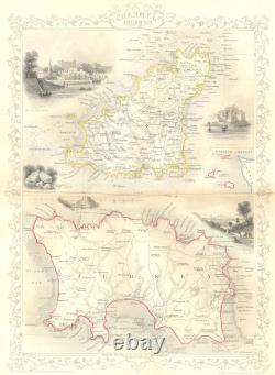
CHANNEL ISLES. Tallis Jersey Guernsey 1855 old antique vintage map plan chart


Antique engraved map with outline colour, 1855. Title of map:'Channel Islands. The image below shows an enlarged cross section from the centre of the map to show the level of printed detail. This map is folding hence the centrefold line may show on the image below. IMAGE SIZE: Approx 34.5 x 25.0cm, 13.5 x 10 inches (Large); Please note that this is a folding map. ARTIST/CARTOGRAPHER/ENGRAVER: The map Drawn & engraved by J. Rapkin; the illustrations by H. Winkles & engraved by E. PROVENANCE: Published by John Tallis & Company, London & New York. TYPE: Antique engraved map with outline colour. VERSO: There is nothing printed on the reverse side, which is plain. CONDITION: Good; suitable for framing. Virtually all antiquarian maps and prints are subject to some normal aging due to use and time which is not obtrusive unless otherwise stated. AUTHENTICITY: This is an authentic historic print, published at the date stated above. I do not offer reproductions. It is not a modern copy. The term'original' when applied to a print means that it was printed at the first or original date of publication; it does not imply that the item is unique. Print' means any image created by applying an inked block to paper or card under pressure by any method including wood engraving, steel engraving, copperplate, wood cut and lithography.
REMARKS: FRANCE: Gravures et Cartes anciennes. DEUTSCHLAND: Alte Lankarten und Stadt ansichten. ITALIA: Stampe e Mappe antiche. ESPAÑA: Mapas antiquos y impresiones antiguas.

